Signed on September 10, 1853, the Table Rock Treaty ended that year’s Rogue River War under heavy military pressure. Rogue Valley leaders ceded over two million acres of homeland in exchange for a temporary reservation and a promised $60,000.
The federal government withheld $15,000 of those funds to compensate settlers for war damages. This forced the tribes to finance settler losses from their own land payments.
Promised supplies and federal protection largely failed to materialize for the tribes. The reservation lasted less than three years amidst rising local tensions.
In early 1856, after renewed violence, officials forced residents on a brutal winter march to the Grand Ronde Reservation. Descendants maintain an enduring connection to the Table Rocks today.
What Did the Two September 1853 Treaties Establish?
Two separate documents emerged from the 1853 Council of Table Rock: a September 8 peace treaty and a September 10 land cession treaty.
Only the second was ratified, becoming the legal basis for the reservation and tribal land loss. This critical chapter reshaped indigenous sovereignty throughout the Oregon Territory.
It permanently altered homelands across southern Oregon.
Gold-Rush Encroachment and Military Pressure on Rogue Valley Peoples
The Takelma, Latgawa, Shasta, and Athapaskan peoples lived in the Rogue River Valley for generations. Collectively called the Rogue River Indians by settlers, they maintained distinct communities and territories.
Their food came from salmon runs, acorns, camas bulbs, and local game. Seasonal plants supported communities throughout southwestern Oregon.
Gold discoveries near Jacksonville in 1851 brought thousands of miners. Mining muddied salmon streams, while farms and livestock overtook oak groves and camas meadows.
In June 1851, the U.S. Army attacked local villages, killing about 50 people and taking captives. Retaliatory killings quickly escalated across the entire region. Volunteer militias frequently raided Native camps without distinction.
By August 1853, fighting at Evans Creek set the stage for formal talks.
Joseph Lane and the Unratified September 8 Peace Treaty
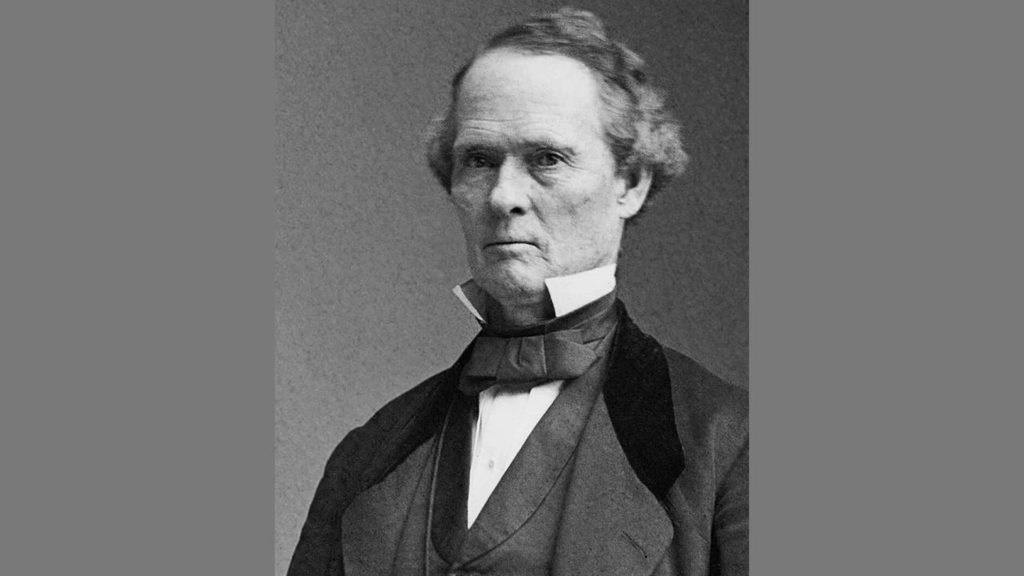
Joseph Lane, Oregon’s congressional delegate and former territorial governor, led the peace talks. He had commanded troops in August and brought the weight of the military behind him.
Talks occurred north of the Rogue River near Lower Table Rock. The site sat within a valley formed by horseshoe-shaped Table Rock.
Words passed from Takelma into Chinook Wawa and then into English. This chain of translation left substantial room for misunderstandings. The September 8 peace treaty halted active fighting.
However, the U.S. Senate never formally ratified it.
Joel Palmer, Samuel Culver, and the September 10 Cession Treaty
Superintendent Joel Palmer and agent Samuel Culver signed a separate land cession treaty two days later. The text names Palmer and Culver as U.S. negotiators at Table Rock on September 10, 1853.
The cession treaty directly references the earlier peace agreement. It tied land sales to the end of hostilities while remaining legally distinct.
Chief Joe, Chief Sam, and Chief Jim as Signers
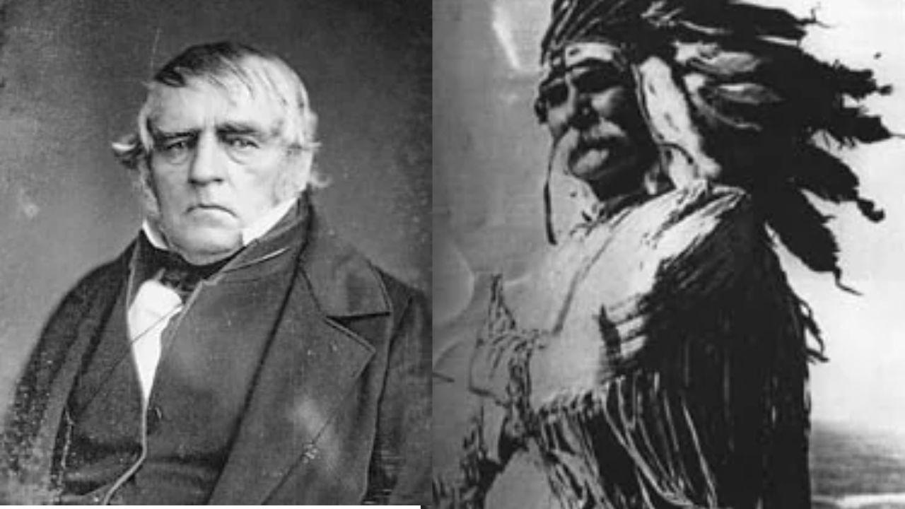
Leaders called Chief Joe, Chief Sam, and Chief Jim signed for their people. Their names appear phonetically in records as “Jo-aps-er-ka-har” and “To-qua-he-ar.” Apserkahar and Toquahear were brothers who led local bands.
Sam’s Valley, located within the reservation, bears Chief Sam’s name.
Land Ceded and Senate Ratification in April 1854
Tribes gave up title to an estimated two million-plus acres of the Rogue River Valley. The Senate approved the accord on April 12, 1854, making it a foundational Pacific Northwest treaty.
Preserved within the National Archives, it was the first ratified land treaty with tribes in the American West.Its legal structure established a blueprint for negotiations across Oregon Territory.
The $60,000 Promise and $15,000 Withheld
The treaty promised $60,000 for the ceded land over several decades. It withheld $15,000 of that total to pay settlers for property destroyed during the war.
Remaining payments were designated for periodic goods and services rather than direct cash. This forced tribes to pay for damages from a conflict sparked by settler encroachment.
Native losses in lives, homes, and food stores received no matching compensation. This penalty deepened the hardship caused by losing ancestral lands.
| Treaty term | Amount or detail |
|---|---|
| Land ceded | An estimated 2 million-plus acres |
| Total promised | $60,000 |
| Withheld for settler damages | $15,000 |
| Remaining for tribes | $45,000, mostly in goods over time |
| Ratified | April 1854 |
Where Was the Reservation, and What Was Promised?
The reservation sat north of the Rogue River around the two Table Rocks. It served as a temporary home until the government selected a permanent site.
A Temporary Homeland of Roughly 100 Square Miles
The Table Rock Reservation covered roughly 100 square miles of territory. It encompassed Upper and Lower Table Rock, Sam’s Valley, and adjacent creek watersheds.
The boundary retained key fishing stations along the Rogue River. Sources describe it as a short-lived reservation north of the Rogue River.
Tribal residents never received permanent legal title to the tract. Settler encroachment surrounded the reserve from its inception.
Farming Assistance and Delayed Promises
The treaty guaranteed agricultural tools, livestock, clothing, and housing for leaders. These resources were meant to replace traditional hunting and gathering grounds.
Much of this assistance arrived late, in poor condition, or not at all. Reservation residents faced persistent food shortages and deadly diseases.
Nearby settlers and miners repeatedly trespassed and threatened residents. River fishing sites alone could not sustain the confined populations.
Fort Lane’s Protective Role
The U.S. Army established Fort Lane in late September 1853 opposite the reservation. Capt. Andrew Jackson Smith commanded a dragoon company stationed there.
The garrison was intended to shield Native families from settler aggression. In practice, soldiers primarily monitored tribal movements and maintained regional order.
The fort’s limited numbers failed to deter aggressive local volunteer militias. Tensions continued to mount along the reservation’s borders.
Related Agreements: Cow Creek and Additional Bands
Palmer concluded a separate agreement with the Cow Creek Umpqua on September 19, 1853. That treaty involved entirely distinct lands and sovereign tribal groups.
In November 1854, another treaty relocated additional Rogue River bands to Table Rock. These treaties expanded the federal reservation framework across southwest Oregon.
How Did Violence Lead to Forced Removal in 1856?
A settler attack in October 1855 shattered the area’s fragile peace. Within months, reservation residents faced military orders for forced removal.
The Lupton Massacre and Fort Lane Refuge
On October 8, 1855, armed volunteer vigilantes attacked a Native camp near Upper Table Rock. Led by James Lupton, the attackers killed 23 to 30 elderly people, women, and children.
Native warriors carried out retaliatory strikes on surrounding settlements the next morning. These clashes triggered the final phase of the Rogue River War.
Many Takelma families refused to fight and sought sanctuary at Fort Lane. Army officers confined them under armed guard as hostilities expanded.
Battle of Hungry Hill and Renewed Warfare
On October 31 and November 1, 1855, Native fighters defeated federal troops at Hungry Hill. This engagement proved the resisting bands possessed formidable defensive strength.
Combat swept down the canyon toward the remote Oregon coastline. Leaders like Chief John maintained resistance deep into 1856.
The war claimed between 235 and 267 Native lives in total. Military pressure ultimately overwhelmed surviving indigenous fighters.
Forced Winter March in February 1856
Palmer determined reservation residents faced imminent slaughter if they remained in southern Oregon. He ordered their transfer north to the newly designated Grand Ronde Agency.
Palmer had previously worked with the army to buy settler claims in the Willamette Valley. Federal troops forced tribal families to begin the long trek in midwinter.
An Estimated 260 Miles to Grand Ronde
The forced march proceeded between February 23 and March 25, 1856, along the Applegate Trail. The grueling 33-day journey resulted in at least seven documented deaths.
The Confederated Tribes of Grand Ronde document a forced trek of 263 miles from Table Rock. Exiled peoples walked through mud, freezing rains, and heavy snow.
This brutal relocation is remembered today as Oregon’s Trail of Tears. Wagons hauled the sick and elderly over hazardous mountain trails.
Reservation Closure and Settler Land Access
The forced removal formally ended the Table Rock Reservation experiment. The army abandoned Fort Lane, allowing white settlers to claim the reservation land.
Coastal combatants captured later that summer were sent to the Coast Reservation. In 1857, officials transferred additional families to Siletz, fracturing ancestral bands.
How Have Tribal Nations Endured Since Removal?
Descendants survived displacement and now belong to two federally recognized tribes. Their subsequent history includes termination policies and long restoration campaigns.
Grand Ronde and Siletz Tribal Communities
The Confederated Tribes of Grand Ronde and Siletz Indians both include Table Rock descendants. Each confederation unites dozens of western Oregon tribes relocated onto shared reservations.
Grand Ronde includes Takelma, Upper Takelma, Latgawa, Shasta, Applegate, and Galice lineages. Descendants later filed claims for unpaid treaty funds and confiscated lands.
Termination and Restoration
In 1954, Congress passed Western Oregon Termination acts stripping recognition from these tribes. Policy severed the federal trust relationship while community identity endured.
Federal actions stripped remaining tribal services and liquidated communal reservation lands. Tribal leaders mobilized for decades to reverse the termination status.
Siletz secured restored recognition in 1977, followed by Grand Ronde in 1983. Both nations have rebuilt self-governance and sovereign community institutions.
Table Rock Today
The Table Rocks are now protected public and conservancy lands. Federal agencies and The Nature Conservancy oversee the geological landmarks today.
The mesas remain sacred cultural sites for modern Takelma descendants. Tribal members frequently return to honor ancestral lands and traditions.
A Temporary Homeland and an Enduring Tribal Connection
The Table Rock Treaty ended the 1853 war under extreme military pressure. Native peoples surrendered two million acres for an unstable reservation and unpaid promises.
Settlers received $15,000 from tribal funds to compensate for war property losses. This injustice profoundly affected indigenous communities throughout southwest Oregon.
The 1855 Lupton Massacre demolished the fragile peace and triggered renewed war. Removal in 1856 drove remaining residents 260 miles north to Grand Ronde.
Restored tribal nations at Grand Ronde and Siletz preserve their enduring heritage today. The 1853 treaty remains central to understanding Oregon’s territorial history.
Frequently Asked Questions
Where can I read the original Table Rock Treaty PDF?
Oklahoma State University hosts the ratified 1853 treaty text within its Treaty with the Rogue River, 1853 collection. The National Archives preserves the original document, while Oregon’s education department provides classroom PDFs.
Where can I find a map of the original Table Rock Reservation?
Historical records, such as the 1855 Belden survey map, depict the reservation boundaries. State and tribal archives host scans displaying Sam’s Valley and adjacent creeks.
Was the Table Rock Treaty the same as the Cow Creek Umpqua treaty?
No, the Cow Creek treaty was signed on September 19, 1853, with a different tribe. Table Rock pertained strictly to Rogue Valley bands signed on September 10.
What was the connection between the Lupton Massacre and the Battle of Hungry Hill?
The Lupton Massacre provoked retaliatory attacks that rekindled the Rogue River War. Weeks later, allied Native warriors defeated federal soldiers at Hungry Hill.
Why were people removed from Table Rock to Grand Ronde in 1856?
Militia violence made reservation security impossible while settlers demanded Native land. Superintendent Joel Palmer ordered the forced winter march to clear the Rogue Valley.

Cory is a website owner and content creator who enjoys fishing, history, coin collecting, and sports, among other hobbies. He is a husband and father of four.
Romans 15:4 For whatever was written in former days was written for our instruction, that through endurance and through the encouragement of the Scriptures we might have hope.