Fort Lane was a short-lived but pivotal United States Army fortification in Jackson County, Oregon, established on September 21, 1853, to maintain an uneasy armed truce between incoming white settlers and the Native peoples of the Rogue River Valley.
Garrisoned by elements of the 1st U.S. Dragoons under Captain Andrew Jackson Smith, the outpost functioned for exactly three years during the height of the Rogue River Wars.
Although military installations bearing the name Fort Lane existed during the nineteenth century in both Florida and North Carolina, the post in southwestern Oregon occupies a singular place in the history of the Pacific Northwest.
Today, Fort Lane is protected as a historic property in southern Oregon.
Preserved along the banks of the Rogue River, its buried archaeological remains and solitary stone marker testify to a violent period of colonial dispossession, treaty-making, military peacekeeping, and eventual forced deportation.
The Rogue Valley Before Fort Lane
For thousands of years prior to the appearance of Euro-American fur trappers and overland emigrants, the watershed of the Rogue River supported dense, vibrant Indigenous populations.
The geography of the valley—framed by the Cascade Mountains to the east, the Siskiyou Mountains to the south, and the rugged Coast Range to the west—fostered distinct regional cultures.
These groups lived in semi-permanent river villages during winter months and dispersed to seasonal upland hunting and foraging camps throughout spring, summer, and autumn.
Their subsistence practices were intimately tuned to regional microenvironments and riverine life.
Indigenous Peoples and Territorial Boundaries
The Indigenous population of southwestern Oregon was ethnolinguistically varied, divided into several distinct language groups whose boundaries followed key river valleys and tributary basins.
| People | Linguistic Stock | Traditional Territory | Key Settlements & Geography |
|---|---|---|---|
| Takelma | Takelman (Penutian) | Middle Rogue River basin | Table Rock, Bear Creek, Jumpoff Joe Creek |
| Latgawa | Takelman (Upland dialect) | Upper Rogue River cascade foothills | Headwaters of Rogue River and upper Bear Creek |
| Shasta | Shastan (Hokan) | Klamath drainage and southern valley borders | Modern Ashland area, Siskiyou Pass, Shasta Valley |
| Athabaskans | Pacific Coast Athabaskan | Lower Rogue River canyon and tributaries | Applegate River (Dakubetede), Galice Creek, Illinois River |
The Takelma, whose autonym translates broadly to “those dwelling along the river,” formed the demographic core of the middle valley.
The river provided massive annual runs of chinook salmon, coho salmon, and steelhead trout, which were speared, netted at cascades, dried on elevated racks, and cached in subterranean pits for winter sustenance.
Oak savannas and open foothill prairies yielded vast stores of black oak and white oak acorns.
Women gathered acorns in burden baskets, ground them with stone mortars and pestles, leached out the bitter tannic acid with hot water, and cooked the resulting meal into nutritious mushes and cakes.
In low, damp meadows throughout the valley floor, the blue-flowering camas lily grew in abundance.
Bulbs were harvested with wooden digging sticks during early summer and slow-roasted for days in earthen ovens, producing a sweet, caramel-like food staple that could be dried and pressed into cakes for storage.
Controlled ecological burning was central to local Indigenous resource stewardship.
Every autumn, Takelma and Latgawa bands set deliberate ground fires to clear brush, stimulate fresh browse for black-tailed deer and elk, suppress insect pests, and encourage the growth of wild seed grasses, berries, hazel shoots for basketry, and oak trees.
The Overland Trail and the 1852 Gold Rush
Contact between these native cultures and Euro-Americans began sporadically in the late 1820s when Hudson’s Bay Company fur brigades, led by trappers such as Peter Skene Ogden, traversed the valley.
Early French-Canadian and American trappers dubbed the Native inhabitants les coquins (“the rogues”) due to their fierce resistance to trespassers, giving the river and region its lasting name.
In 1846, Jesse and Lindsay Applegate surveyed a southern alternative to the Oregon Trail, known as the Applegate Trail or South Road to Oregon.
Emigrant wagon trains rolled through the heart of Takelma and Shasta lands on their way to the Willamette Valley, sparking frequent armed skirmishes over cattle thefts, trampled vegetation, and unprovoked shootings.
The tipping point occurred in January 1852, when prospectors James Cluggage and James Pool uncovered rich placer gold deposits on Rich Gulch, a tributary of Jackson Creek.
Within weeks, the mining town of Jacksonville sprang into existence, triggering a chaotic influx of thousands of miners, merchants, packers, and speculative homesteaders.
This demographic explosion had immediate, devastating consequences for the native ecosystem.
Placer miners redirected streams, erected sluices, and stripped topsoil down to bedrock, dumping suffocating sediment into riverbeds and destroying ancestral salmon spawning beds.
Settlers staked donation land claims across prime camas meadows, introducing herds of cattle and hogs that uprooted wild food plants and consumed the acorn crops upon which Native communities relied.
Cut off from traditional food networks, facing starvation, and subjected to indiscriminate violence from unruly miners, Indigenous bands struck back against pack trains, isolated cabins, and prospecting camps.
Further Reading: 10 Historic Forts in Oregon
The 1853 War and the Table Rock Treaty
By the midsummer of 1853, open warfare raged across southwestern Oregon.
Settler families abandoned their homesteads and fled to makeshift fortified stockades in Jacksonville and surrounding settlements, while territorial militia companies mobilized to wage offensive campaigns against Native strongholds.
In response to desperate appeals from local citizens, former territorial governor and Mexican-American War veteran Joseph Lane assumed command of the disorganized volunteer forces.
Lane coordinated operations with Captain Bradford Alden, who commanded a small detachment of regular U.S. Army soldiers from Fort Jones, California.
On August 24, 1853, combined volunteer and regular forces attacked a substantial Takelma and Shasta force in the dense timber along Evans Creek.
Tribal leaders such as Apserkahar (Chief Joe), Toquahear (Chief Sam), Cholcultah, and Ana-cha-a-rah (Jim) directed the resistance.
The engagement was bitter and bloody. Captain Alden was severely wounded, and General Lane suffered a bullet wound through his shoulder.
Despite heavy losses on both sides, Lane recognized that an outright military victory in the rugged mountain terrain was impossible.
During a lull in the fighting, he initiated parleys with Apserkahar and negotiated an armistice, agreeing to meet for formal peace negotiations at the foot of Table Rock in September.
The Treaty Council of September 1853
On September 8, 1853, negotiators convened on a low terrace near the south face of Lower Table Rock.
The council included General Lane, federal Indian Superintendent Joel Palmer, local agent Samuel Culver, interpreter James Lupton, and numerous tribal leaders, along with hundreds of fully armed Native warriors positioned on the surrounding slopes.
| Instrument | Date Signed | Signatories & Principals | Key Provisions & Status |
|---|---|---|---|
| Armistice & Preliminary Terms | September 8, 1853 | Joseph Lane, Chief Joe (Apserkahar), Chief Sam | Immediate cessation of hostilities; agreement to surrender rifles; preliminary reserve designated. |
| Treaty with the Rogue River | September 10, 1853 | Joel Palmer (Superintendent), Chief Joe, Chief Sam, Jim, Lympe | Cession of 2,500 sq. miles; establishment of Table Rock Reservation; $60,000 indemnity; Senate ratified April 1854. |
The treaty proceedings required complex translation chains: statements delivered in Takelma and Shasta were translated into Chinook Wawa (the regional trade jargon), which was then rendered into English, and vice versa.
Despite the deep suspicion on both sides, the parties concluded the formal Treaty with the Rogue River on September 10, 1853.
Under the treaty’s terms, the confederated bands surrendered title to roughly 2,500 square miles of the Rogue River Valley, reserving a temporary sanctuary of approximately 100 square miles north of the river, bounded by Table Rock and Evans Creek.
Key leaders, including Chief Joe and sub-chief Lympe, attached their marks to the accord.
The federal government promised an annuity of $60,000, compensation for surrendered firearms, the provision of agricultural tools, a resident physician, a blacksmith, and school instruction.
Crucially, tribal leaders demanded the presence of regular federal soldiers rather than volunteer militiamen.
The chiefs openly declared that they could not trust local settlers or miners to honor the peace, requesting an Army garrison positioned between the reserve and the mining camps to guarantee their safety.
Establishment and Construction of Fort Lane
Immediately following the signing of the treaty, Captain Bradford Alden’s wounded state required him to yield field command to Captain Andrew Jackson Smith of the 1st U.S. Dragoons.
The temporary staging point used during the treaty council, dubbed Camp Alden, was deemed unsuitable for long-term winter habitation.
On September 21, 1853, Captain Smith selected a strategic site approximately ten miles north of Jacksonville, on a broad alluvial terrace along the south bank of the Rogue River directly opposite the Table Rock Reservation.
In official general orders, the post was designated Fort Lane, honoring Joseph Lane for his role in concluding the recent conflict.
Layout and Architecture
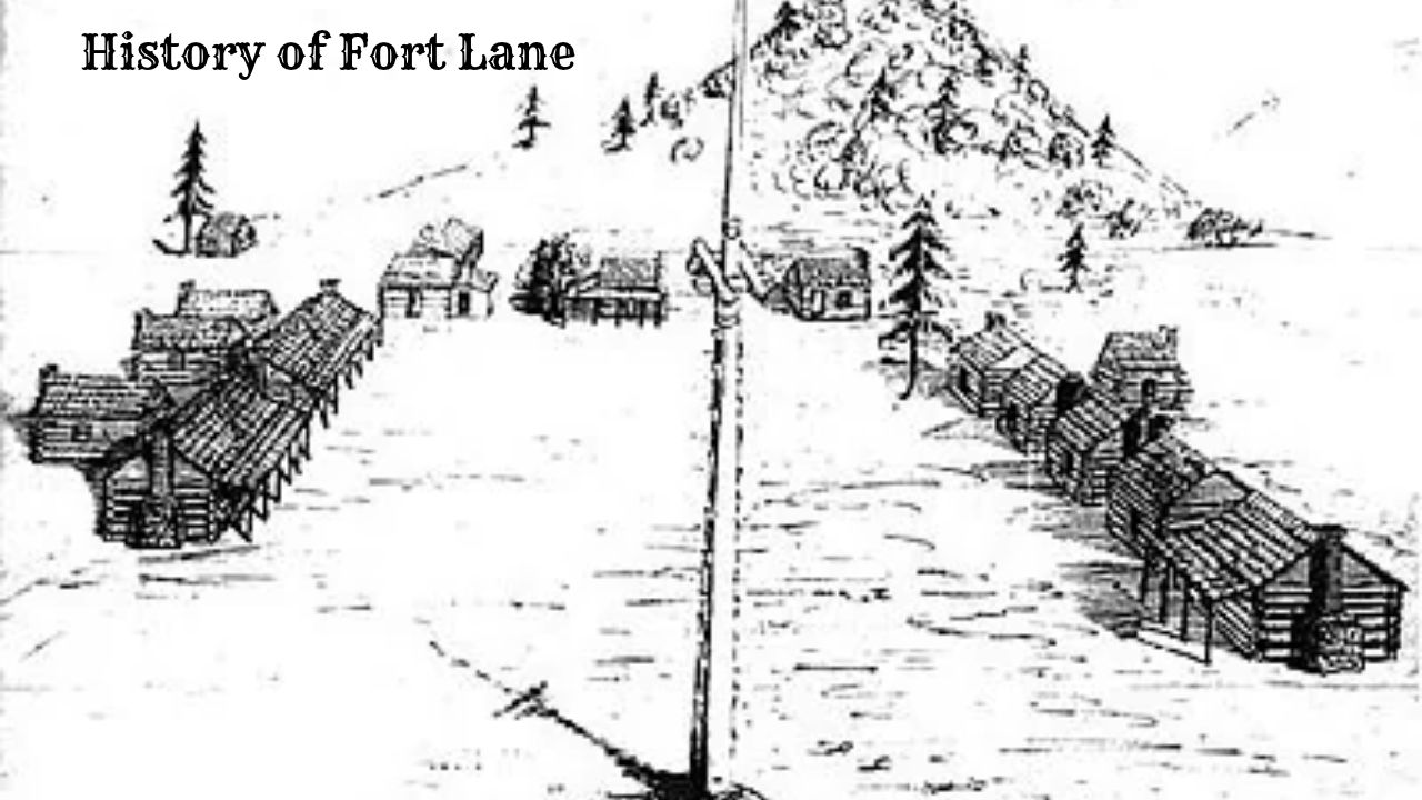
Constructed through the hard labor of enlisted dragoons between late 1853 and early 1854, Fort Lane followed standard frontier military design, organized around an open central parade ground that served for morning roll calls, drills, and formal inspections.
| Structure Type | Dimensions & Materials | Occupants / Function | Archaeological & Historic Notes |
|---|---|---|---|
| Officers’ Quarters | Squared log and frame; finished stone hearths; brick chimneys | Captain Smith, lieutenants, post surgeon | North side of parade ground; contained imported window glass, iron hardware, and plastered walls. |
| Enlisted Barracks | Hewn log structures; wooden plank floors; fieldstone fireplaces | Companies C and E, 1st U.S. Dragoons (~50–80 men per barrack) | South and east perimeters; crowded multi-tier bunks with straw ticking; rough interior finishes. |
| Dragoon Stables | Heavy timber pole construction; split-rail corrals | Mouthed cavalry horses and draft mules (~100 mounts) | Located downwind toward the western riverbank; vital for mounting rapid cavalry intercept patrols. |
| Hospital & Dispensary | Single-story log; partitioned exam room and patient ward | Assistant Surgeon Charles Henry Crane; wounded and sick soldiers | Treated battle wounds, accidental trauma, dysentery, scurvy, and respiratory illness. |
| Bakehouse & Commissary | Heavy log frame with large masonry bread ovens | Enlisted bakers and quartermaster staff | Produced daily sourdough loaves; stored salt pork, flour barrels, coffee, and beans. |
| Guardhouse | Reinforced squared timber; barred windows; holding cells | Military prisoners, deserters, and civilian detainees | Used to enforce military discipline and hold suspected vigilantes or refractory warriors. |
Unlike classic frontier fortifications depicted in popular fiction, Fort Lane lacked stockade walls, bastions, or blockhouses.
The U.S. Army relied upon its mobile cavalry presence, carbines, and mounted field howitzers to deter any organized assault.
Life at the Garrison and Fragile Peacekeeping
Throughout 1854 and early 1855, Fort Lane operated under the constant strain of keeping two mutually hostile populations apart.
Captain Andrew Jackson Smith was tasked with preserving the peace with fewer than one hundred regular soldiers under his direct command.
Logistics and Daily Realities
Maintaining a military post in the interior of southwestern Oregon presented formidable logistical hurdles. The garrison depended entirely upon supply lines extending hundreds of miles from Pacific ports.
Steamers carried hardtack, salt pork, uniforms, sabers, percussion caps, and correspondence from San Francisco north to the coastal enclave of Crescent City, California.
From Crescent City, long mule pack trains operated by civilian contractors traversed the treacherous, precipitous trails over the Coast Range and Siskiyou Mountains into the Rogue Valley.
During the winter rainy season, mountain passes were blocked by snowdrifts, while valley roads dissolved into impassable bogs of deep clay mud.
Rations often ran low, forcing soldiers to subsist on locally purchased beef and flour at exorbitant frontier prices.
Daily routines for the dragoons revolved around arduous physical duties.
Men spent daylight hours grooming and exercising cavalry horses, repairing harness leather, cleaning carbines and Colt dragoon revolvers, felling timber for firewood, digging latrines, and conducting mounted drill across the grassy bottomlands.
Boredom was pervasive, leading many enlisted men to seek escape in Jacksonville’s saloons, bowling alleys, and gambling halls. Incidents of drunkenness, brawling, and desertion were frequent, requiring steady discipline and confinement in the post guardhouse.
The Intermediary Role
Despite these internal challenges, Captain Smith and his junior officers, including Lieutenant George Crook, took their peacekeeping mandate seriously.
The dragoons patrolled the perimeter of the Table Rock Reservation, turning back trespassing white miners, timber cutters, and whiskey peddlers.
When settlers accused Native bands of livestock theft, Smith dispatched patrols to investigate claims, often discovering that stray cattle had merely wandered off into brush canyons rather than being butchered.
On multiple occasions, Smith positioned his armed troops between belligerent settler mobs and peaceful reservation villages, earning the bitter enmity of local civilian extremists who viewed regular army officers as Indian sympathizers.
Simultaneously, the post hosted recurring diplomatic councils.
Tribal leaders crossed the Rogue River to confer with Smith and Indian Agent Samuel Culver, complaining that promised annuities were delayed, that miners continued to contaminate river waters, and that white vigilantes were threatening isolated family groups.
The Outbreak of the 1855–1856 War
The fragile equilibrium preserved by Fort Lane disintegrated during the autumn of 1855. In September, a series of violent incidents along the Klamath and Rogue rivers reignited civilian hysteria, leading to the formation of unorganized, independent settler militias known as “exterminators.”
The Lupton Massacre
On the night of October 7, 1855, a self-organized volunteer company assembled in Jacksonville under the leadership of James A. Lupton, a newly elected member of the territorial legislature. Inflamed by alcohol and inflammatory speeches, the militia marched toward the mouth of Little Butte Creek, adjacent to the Table Rock Reservation.
At dawn on October 8, Lupton’s men staged a surprise attack on an unsuspecting, peaceful Takelma encampment consisting primarily of old men, women, and children. The militiamen slaughtered roughly forty Native people in cold blood, burning their wickiups and personal property.
Lupton himself was killed during the melee by an arrow through the throat, but the massacre irrevocably shattered whatever trust remained in the Table Rock Treaty. Bands that had stayed at peace realized that the federal government could not guarantee their safety.
The General Uprising and the Battle of Hungry Hill
Following the massacre, Chief Joe and Chief Sam led their bands directly across the river to seek sanctuary behind the dragoon lines at Fort Lane, placing themselves under Captain Smith’s direct physical protection.
However, several other prominent war chiefs—most notably Tecumtum (known to settlers as Chief John) and Enos, an Athabaskan leader—refused to submit to passive confinement.
Tecumtum’s warriors launched a coordinated sweep down the Rogue River canyon on October 9, burning ranches, wagon trains, and stage stations, killing dozens of white settlers.
Armed conflict erupted across hundreds of square miles of southwestern Oregon, pulling the regular garrison at Fort Lane into full-scale offensive operations.
On October 31, 1855, Captain Smith led a combined force composed of 105 regular dragoons and infantry from Fort Lane and Fort Jones, joined by roughly 250 territorial volunteers under Colonel John E. Ross, into the steep, brush-choked Grave Creek Hills north of modern Grants Pass.
At a rugged, waterless ridge known as Hungry Hill, the joint force attacked a fortified position held by approximately two hundred Takelma and Shasta warriors under Tecumtum and Chief George.
The resulting Battle of Hungry Hill was a disaster for the American forces.
Native snipers, hidden in dense manzanita thickets and rocky outcrops, pinned down the troops in narrow ravines.
Volunteers panicked and fell back in disorder, forcing Captain Smith’s regular soldiers to fight a desperate rearguard action without water or medical shelter.
The military suffered thirty-one casualties, including nine regulars and seventeen volunteers killed or mortally wounded, before making a humiliating retreat back to Fort Lane.
Defeat, Removal, and Decommissioning
The defeat at Hungry Hill shifted federal military strategy.
General John E. Wool, commander of the Army’s Department of the Pacific, arrived in Oregon convinced that local settler aggression was the root cause of the war, yet resolved to end hostilities through overwhelming regular force.
The Final Campaigns and Coastal Removal
Throughout the bitter winter of 1855–1856, Fort Lane served as a heavily guarded internment depot.
Over four hundred peaceful Takelma and Latgawa remained confined on the grounds of the fort, protected by Captain Smith’s sentries against repeated threats from vengeful civilian mobs.
In February 1856, federal authorities determined that peaceful cohabitation in southwestern Oregon was no longer possible.
Under the supervision of Indian Superintendent Joel Palmer, federal soldiers and agents organized the forced march of roughly 325 Native men, women, and children from Fort Lane to the newly established Grand Ronde Reservation in the northern Willamette Valley.
| Phase / Event | Dates | Participants / Units | Historical Significance |
|---|---|---|---|
| Grand Ronde Forced March | February 23 – March 25, 1856 | 325 Takelma/Latgawa; escorted by regular troops & agents | A 260-mile trek in freezing rain and snow; eight people died en route; remembered as the Rogue River Trail of Tears. |
| Canyon Operations | March – May 1856 | Regular army columns and territorial volunteers | Relentless pressure on Tecumtum’s mountain camps along the lower canyon, destroying winter food supplies. |
| Battle of Big Bend | May 27–28, 1856 | Capt. A. J. Smith’s company reinforced by Capt. Christopher Augur | Final major battle along lower Rogue; Smith’s encircled command rescued; led to Tecumtum’s ultimate surrender. |
| Abandonment of Fort Lane | September 1856 | Remaining garrison of 1st U.S. Dragoons | With the native populace removed to coast reservations, the fort was declared obsolete and permanently vacated. |
Following the decisive Battle of Big Bend in late May 1856, Tecumtum and his surviving warriors surrendered. Many displaced captives were gathered near the coast at Fort Orford before final deportation.
Over one thousand additional Native people were marched under military guard to coastal reservations, including the Coast (Siletz) Reservation and Grand Ronde.
With the indigenous population completely expelled from the valley floor and mining settlements securely established, the strategic utility of Fort Lane vanished.
In September 1856, the Army issued orders to decommission the post, dispatching its dragoon companies to Fort Yamhill and other northern installations.
Historical Legacy and Archaeology
Following its abandonment in 1856, Fort Lane fell rapidly into disrepair.
Nearby farmers and settlers recycled its log walls, squared timber beams, and stone foundations into barns, fencing, and hearths, clearing the riverside terrace for agriculture and livestock grazing.
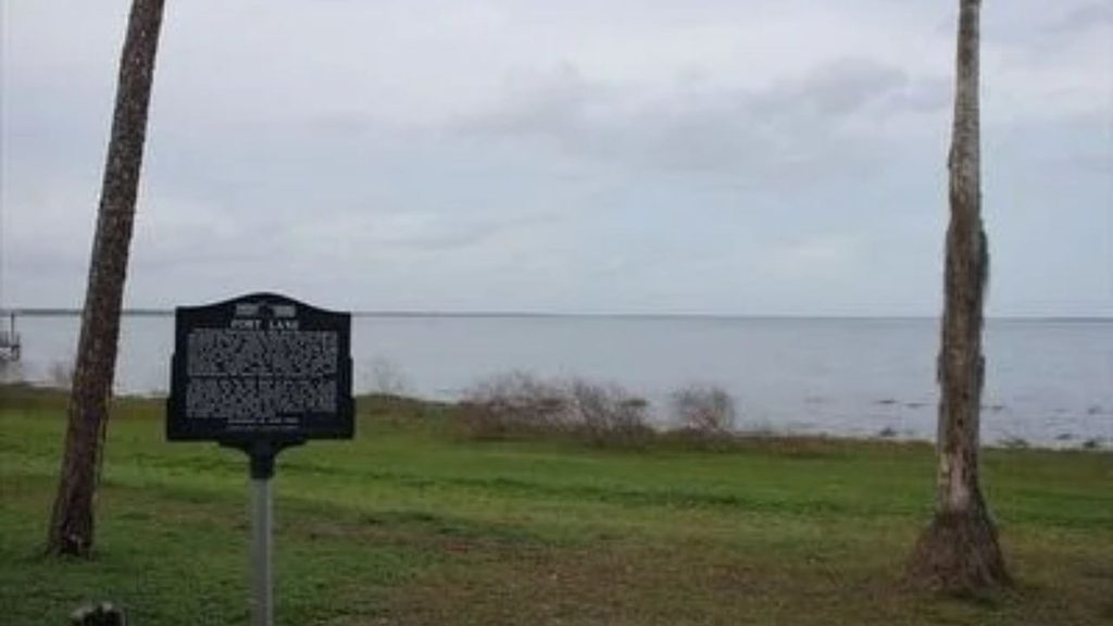
In 1929, the Greater Jackson County Historical Society erected a commemorative stone monument near the fort’s former parade ground, embedding original river stones from the officers’ fireplaces into the masonry pillar.
Between 2000 and 2012, the site was the focus of rigorous historical and archaeological investigations led by the Southern Oregon University Laboratory of Anthropology (SOULA) in cooperation with Jackson County Parks and the Confederated Tribes of Siletz Indians and Grand Ronde.
Excavations uncovered structural foundations, cellar pits, military insignia, buttons, percussion caps, medicine vials, and trade beads, offering valuable empirical insight into garrison life on the Pacific frontier.
The site gained formal recognition when it was listed on the National Register of Historic Places. Today, the site is managed in partnership with the Oregon Parks and Recreation Department and local county agencies.
Although no original wooden structures remain standing, interpretive panels, walking trails, and views toward Table Rock preserve the memory of Fort Lane and its role in the Rogue River War.

Cory is a website owner and content creator who enjoys fishing, history, coin collecting, and sports, among other hobbies. He is a husband and father of four.
Romans 15:4 For whatever was written in former days was written for our instruction, that through endurance and through the encouragement of the Scriptures we might have hope.